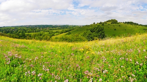
St Catherine's Hill Nature Reserve

St Catherine's Hill, Winchester, by Ed Merritt

St Catherine's Hill, Winchester, by Ed Merritt

Chalk Grassland Restoration Project

Please note - an excavator is currently on-site conducting vegetation scraping as part of our chalk grassland restoration project. This process involves removing the nutrient layer, primarily roots of nettles, to prepare for seeding with chalk grassland species in the upcoming spring.

During these works, the grass on the slope, visible from various points in Winchester, is being removed, revealing soil and chalk underneath. Additionally, new fencing is being installed to facilitate grazing upon completion of the restoration.

This initiative is dedicated to enhancing biodiversity and preserving the unique ecosystem of the area. We sincerely apologise for any inconvenience this may cause and appreciate your understanding and cooperation during this project.

A beautiful chalk downland hill offering fantastic views over Winchester

Location

Garnier Road
Winchester
Hampshire
SO23 9PA

OS Map Reference

SU 484 276
A static map of St Catherine's Hill Nature Reserve

Know before you go

Size
47 hectares
z

Entry fee

Donations welcome
P

Parking information

Parking available on Garnier Road just before the bridge over the river

Grazing animals

Our sites are grazed all year by livestock. Please follow the signage on site.

Walking trails

The hill stands 70m above the river valley with 100+ steps on the north and south sides. There is a flatter route via the surfaced footpath parallel to the Itchen Navigation, then along the unsurfaced bridleway along Plague Pits Valley. There are worn grass paths that criss-cross the hill, valley and ridge. Beware of rabbit holes if venturing off the paths. 

Access

Paths are unsurfaced and uneven in places.  Contact the Trust for disabled access.

From the south take junction 10 off the M3 and take the first exit off the roundabout. Immediately after the railway bridge turn left into small car park. From the north take junction 9 off the M3 and take the A272. At the roundabout take the second exit (A31) then pass under the M3. At the roundabout take the first exit then immediately after the railway bridge turn left into small car park.

Train station: Winchester (2 1/2 miles). Take a bus to St. Catherine’s park and ride from the train station (1/4 mile).Follow the cycleway that takes you to the main road. Go through the small car park, join the path for 1/3 mile with the river on the right until you reach St Catherine’s lock entrance.

Bus stop: Winchester bus station (2 miles). Take a bus to St. Catherine’s park and ride bus from the bus station and follow direction above (1/4 mile).

Dogs

Under effective control

When to visit

Opening times

Open at all times

Best time to visit

Visit in summer to rest on the grass and admire the wildflowers. On warm days you are likely to see a number of butterflies on the wing.

About the reserve

A dramatic 220ft climb up St Catherine’s Hill’s wooden stairs reveals showstopping views of Winchester city, as well as the Itchen Valley floodplains and the downland it nestles in. At the summit are the earthworks of an Iron Age fort, buried ruins of the Norman chapel that gives the site its name, and a copse of beech trees. In the summer you’ll be able to hear the cackle of a woodpecker, spy buzzards and kestrels hunting in the valley below, and meet our friendly British White cattle that graze the site to encourage wildlife to flourish. British white cattle and sheep graze the site to encourage wildlife to flourish. 

On the way down look out for some of the 25 species of breeding butterfly that call it home, including chalkhill blues, brown arguses and marbled whites. Keen-eyed visitors might also spot some of the rarer orchids dotted across the hill’s slopes and meadows, including bee orchids, fragrant orchids, pyramidal orchids and autumn lady’s tresses. St Catherine’s Hill is a fabulous place to enjoy a summer walk.

Contact us

Bea Walecki

Environmental designation

Scheduled Ancient Monument
Site of Special Scientific Interest (SSSI)

Location map

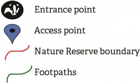
Map key

Map Key